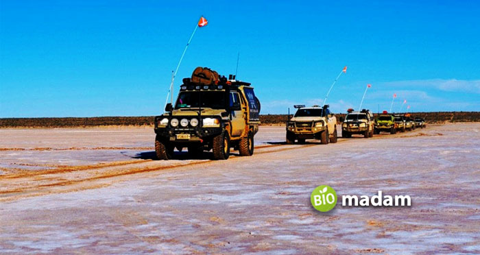
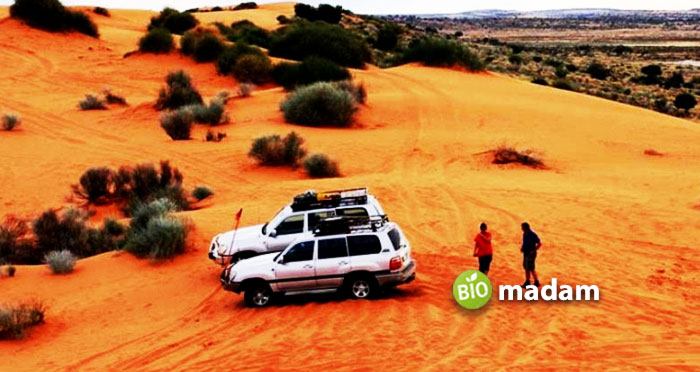
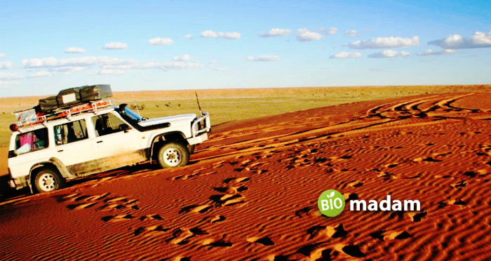
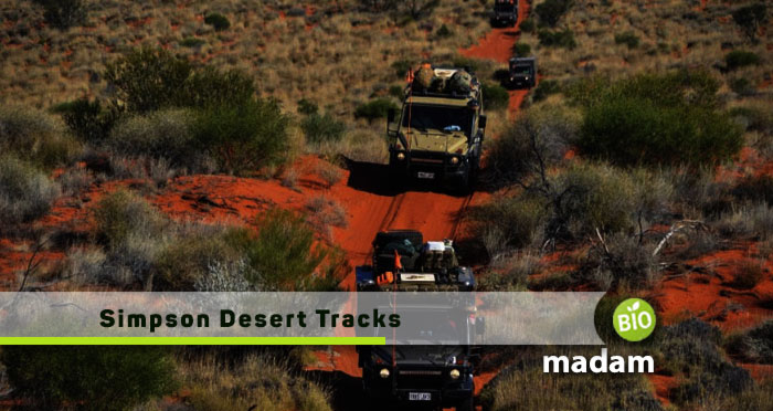
Spanning over 176,000 square kilometers across central Australia, the Simpson Desert represents the pinnacle of outback adventure for 4WD enthusiasts. Its vast sea of imposing red dunes, interspersed by claypans and salt lakes, creates an iconic landscape that demands respect. For those who dare to take on the challenge of crossing this remote and unforgiving terrain, choosing the right track is crucial. This guide explores the varied tracks and pathways that traverse the Simpson, detailing their highlights and hardships.
From the rigorous French Line to the remote Rig Road, each track provides a unique perspective into the Simpson’s captivating yet harsh environment. With thorough planning and preparation, a successful desert crossing promises exhilarating travel and memories to last a lifetime. Let us delve into the realm of the Simpson and discover the right track for your desert ambitions.
Main Tracks in the Simpson Desert
French Line
The French Line is a challenging 260 km single-lane track, often referred to as the “shot line,” stretching from Poeppel Corner to Dalhousie Springs in the Simpson Desert. Constructed by the French Petroleum Company in the 1960s, it remains the shortest and most direct route across the desert. The track is renowned for its difficulty, crossing approximately 1,200 sand dunes at right angles, each presenting a unique challenge for drivers.
The large and steep dunes, coupled with wombat holes, contribute to the French Line’s reputation as one of the toughest tracks in the Simpson Desert. This track is not recommended for novice drivers due to its demanding terrain. A journey along the French Line typically takes about two days to complete, making it a slower option compared to the QAA Line. Adverse weather conditions can significantly increase the difficulty of the trip, requiring careful planning, additional fuel, and experienced off-road driving skills.
QAA Line
The QAA Line, extending over 260 kilometers from Poeppel Corner to Dalhousie Springs, is the most frequently traversed track through the Simpson Desert. As a major route dotted with numerous sand dunes, the QAA Line offers an exhilarating off-road experience for 4WD enthusiasts. The landscape varies from small rolling dunes to steep, imposing sandy ridges reaching heights of over 30 meters. Compared to the French Line, the QAA Line provides a wider, cleared path, though soft sand still demands skillful driving. The larger number of travelers on this track means well-used campsites can be found, like the popular Percy’s Peg near K1 bore.
However, the constant undulating dunes can still cause vehicles to get bogged. While an easier crossing than the French Line, the QAA Line still requires careful preparation, experience, and self-sufficiency when facing the Simpson’s harsh desert conditions. As a vital link across the sprawling desert, the QAA Line allows adventurers to take on the Simpson’s formidable natural beauty. Its changing dune shapes display the desert’s untamed dynamism.
WAA Line
The WAA Line, spanning 120 km in the Simpson Desert, is one of the three main tracks along with the French Line and Rig Road. All three tracks converge at the QAA Line near Poeppel Corner. Similar to the French Line but featuring smaller dunes, the WAA Line offers a scenic and captivating experience, particularly after rainfall when the landscape transforms.
As part of the “Holy Grail” of four-wheel driving in South Australia, the Simpson Desert presents a unique and challenging environment. Located over 1,200 kilometers from Adelaide, this vast expanse covers more than 170,000 square kilometers. The relatively young dunes in the southern part of the desert, formed between 10,000 and 8,000 years ago, contribute to the dynamic and ever-changing nature of the terrain. The WAA Line provides an alternative for those seeking a challenging yet slightly less formidable track compared to the French Line.

Rig Road
Situated towards the western side of the Simpson Desert, the 195 km Rig Road offers a more gradual route with fewer steep dunes compared to the French Line. Built originally to support oil rig equipment transport, its flatter terrain allows for a slightly easier 4WD traverse. However, wide corrugations, bulldust patches, and soft sand still require experience and preparation when crossing. Facilities are spaced farther apart than the French Line but offer welcome rest points when undertaking the multi-day journey.
For those seeking a remote and solitary Simpson Desert crossing, the Rig Road provides a less crowded option. Its minimal dunes reveal more of the flat scrub landscape and swale unique to the desert’s western side. Careful planning for fuel stops is still required given the remoteness. The Rig Road’s scenery and seclusion rewards adventurers with an authentic Outback crossing.
Knolls Track
The Knolls Track is a 42 km link between the French Line and Rig Road, passing through the Simpson Desert’s central region. Unlike surrounding dune terrain, the Knolls Track weaves between the Knolls, which are ancient rocky outcrops that provide a unique landscape. While a relatively short connector track, the Knolls’ imposing dunes on either side still require 4WD skill and experience. Soft sand demands lower tire pressures. Route finding can also be challenging in places.
For those completing a full east-west Simpson crossing, including the Knolls Track adds gorgeous scenery amid the dunes and another layer of adventure. Glimpses of the weathered Knolls geology contrast with drifting sand, providing photographic vistas. While remote, facilities at its start and end points allow for resupply. For 4WD enthusiasts, the Knolls Track makes Simpson Desert crossings more stimulating.
Madigan Line
Traversing the Simpson Desert’s eastern dunes, the remote Madigan Line is named after Cecil Madigan’s 1939 camel expedition. Now a challenging 4WD route, its landscape remains pristine as Madigan found it. Sand dunes run north-south into the distance, topping 30 meters in height. The difficult terrain slows driving to just 15-20 km/hr as endless soft sand bogs vehicles. Steep dunes require power and momentum to ascend and descend. Adding 100-200 km north of the Rig Road, the Madigan Line’s remoteness requires extensive planning and self-sufficiency.
But its demanding adventure provides a special Simpson Desert achievement, rewarded by phenomenal desert scenery from atop the towering dunes. For serious 4WD enthusiasts, Madigan Line’s isolation and challenge make it the ultimate Simpson Desert crossing.
K1 Line
Situated parallel to the remote Madigan Line in the Simpson Desert’s eastern dunes, the K1 Line offers intrepid 4WD enthusiasts another challenging east-west crossing option. While connecting to the same start and end points as the Madigan Line, the K1 provides a route through pristine swales between the towering dunes, most over 30 meters high. Soft sand and steep inclines make for slow going at 10-20 km/hr. Crossing the imposing dunes at right angles also requires power and momentum. The landscape’s remoteness means few signs of civilization exist outside of marker posts.
For those seeking adventure beyond the busier French and Rig Road crossings, the K1 Line gives an untouched Simpson experience. Its seclusion demands careful planning for fuel stops and self-sufficiency. Finishing the K1 Line crossing brings a sense of achievement and a privileged glimpse into the desert’s natural splendor.

Warburton Track
Named after the Australian explorer Peter Egerton Warburton, the Warburton Track is a significant route in the Simpson Desert, linking the Birdsville Track to the K1 Line and Rig Road. The track crosses Warburton Creek, formed by the combined flows of the Eyre Creek and the Diamantina River. This creek, at times, can be impassable when flooded and may take months to subside after spreading into the Goyder Lagoon.
The Warburton Track is part of the K1 Warburton Crossing PAR, providing tourists access to the Simpson Desert Regional Reserve. It can be traversed from the Regional Reserve via the French Line, Rig Road, and K1 Line, offering a diverse and immersive experience in the Simpson Desert’s varied landscapes.
Hay River Track
Situated on the western edge of the Simpson Desert, the remote Warburton Track connects the Colson Track to the Hay River Track, traversing incredibly diverse landscapes. Originally blazed by the explorer Peter Warburton in the 1860s, the track crosses floodplains, claypans, scrub, and occasional dunes. The Warburton Creek crossing links the Eyre Creek and Diamantina River flows, creating a broad floodplain impassable when flooded during the wet season. The track provides vital access to the Simpson Desert Reserve via the K1 Line for 4WD tourists.
For those seeking solitude, the Warburton Track rewards with a peaceful journey through pristine sections of the Simpson. Bush camping under starry night skies adds to the timeless outback experience. While demanding careful planning and 4WD experience, the Warburton Track offers a remote adventure through ever-changing desert environments away from crowded routes.
Additional Highlights and Considerations
Seasonal Considerations
The extreme heat of Australian summer makes Simpson Desert crossings dangerous from November to March when temperatures exceed 40°C. Winter nights can drop below freezing. Peak season is May-August when daytime temperatures range from mild to warm but the risk of rain disrupting travel is lower than in spring.
Notable Landmarks and Attractions
Along with the stunning natural scenery of red dunes and claypans, notable landmarks include Poeppel Corner at the desert’s northern point, and Purnie Bore and Dalhousie Springs along the French Line, which provide natural water sources in the arid landscape. The Knolls and K1 Lines also allow access to the magnificent Madigan Line further east.
Importance of Careful Preparation
Due to the remoteness and harsh conditions, thorough preparation is vital. Supplies should cater for complete self-sufficiency for up to 2 weeks. Essentials include extra fuel, water (at least 20 liters per person per day), food, a first aid kit, tools and spare parts, communications devices, shade/shelter, and vehicle recovery gear.

Routes to the Simpson Desert from Different Starting Points
Embarking on the adventure of crossing the Simpson Desert requires careful thinking about the routes that lead to its huge expanse. Where you start determines the entry points and tracks available to access this famous Australian desert.
- From Alice Springs: For those starting in Alice Springs, two main tracks head towards the Simpson’s western entry points – the Santa Teresa Track and Binns Track. These roads offer a beautiful drive through the rugged landscapes, slowly leading you into the remote center of the desert. It’s a taste of the challenges ahead inside the Simpson.
- From Adelaide: The drive from Adelaide follows the historic Oodnadatta Track, the main route from the southern city to the Simpson Desert. This iconic track takes adventurers through the captivating Flinders Ranges and the well-known outback town of Coober Pedy, setting the scene for the desert crossing. The Oodnadatta Track blends natural wonders and cultural history, getting travelers ready for the Simpson’s rough terrain.
- From Darwin: Leaving from Darwin means heading south on the Plenty Highway, passing Jervois Station, and eventually reaching the Simpson’s eastern entry points. This route highlights Australia’s diverse central desert scenery, hinting at the vastness coming up. The Plenty Highway helps those looking to enter the Simpson Desert from the east, emphasizing the huge distances and isolation of outback travel.
No matter where you start, it’s several days of driving before you reach the Simpson Desert’s heart.
Final Words
The diverse tracks of the Simpson Desert present challenges and rewards unmatched across the Australian Outback. Each crossing tests overlanders’ skills and resilience through ever-changing dunes and stark remoteness. But those who conquer the Simpson’s harsh environment are gifted with an experience of profound natural beauty, solitude, and accomplishment. A successful Simpson Desert expedition promises exhilarating travel and lifelong memories if undertaken with respect, preparation, and self-reliance. For 4WD enthusiasts, the Simpson’s iconic red sands call you to venture into Australia’s final frontier. Traverse its shifting lands and you may uncover your own tracks in the timeless terrain of this great southern desert.

As a freelance journalist, copywriter, and editor, Rachel Truman crafts compelling stories across travel, food, family, lifestyle, and B2B. With a keen eye for detail, Rachel specializes in creating engaging branded content, making every word an adventure

